By Christina Maxouris, CNN
Updated 8:57 AM ET, Sat August 31, 2019

Source: CNN
Long lines for gas across Florida ahead of Hurrican Dorian 02:17
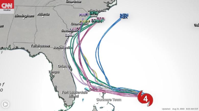
(CNN) Hurricane Dorian's forecast track has become a little murkier, with the range of possibilities for landfall now including not just Florida but also the coasts of Georgia and the Carolinas.
In fact, most models now project Dorian -- now a Category 4 storm -- staying just off Florida's coast Tuesday and Wednesday and eventually crashing into South Carolina's coast Wednesday or Thursday.
Still, there's a lot of uncertainty in the forecast, with the storm still days away from the US coast.
"It's important to note that much of Florida, and the Southeast coast, remain in the forecast 'cone of uncertainty,' meaning landfall is still possible anywhere along the east coast of Florida and points further north," CNN Meteorologist Dave Hennen said.
Read More
Even if the storm's center doesn't smack into Florida, "Dorian is expected to be close enough to the coast to bring life-threatening wind, storm surge, and flooding rains starting early next week," Hennen said.
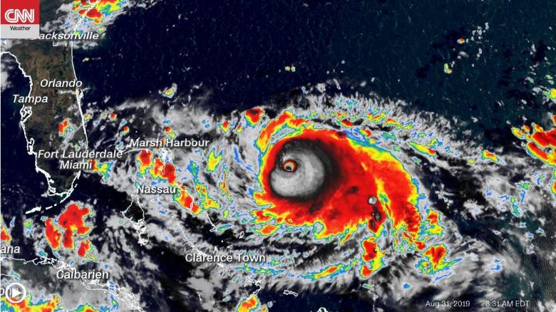
By 8 a.m. ET Saturday, the storm had maximum sustained winds of 145 mph as it neared the northern Bahamas, which Dorian is expected to reach Sunday.
You risk your life if you don't evacuate, Bahamas PM says
The northern Bahamas will start feeling tropical-storm-force winds Saturday night or early Sunday, and those islands -- including Grand Bahama -- are expected to feel the storm's full wrath Sunday evening, with sustained winds up to 145 mph.
"Do not be foolish and try to brave out this hurricane," Prime Minister Hubert Minnis said at a news conference, according to CNN affiliate WPLG. "The price you may pay for not evacuating is your life."

Officials have warned Florida residents
Officials have warned for days about the hurricane's potential impact in Florida, and resident have responded by stocking up on supplies and making evacuation plans.
Forecasts currently show Dorian could move northward along the coast Monday into Wednesday -- but landfall there still is possible.

"It is imperative that all Floridians and their families take this threat seriously and have a plan in place," Gov. Ron DeSantis said earlier this week.
"Even if there isn't a center of the storm over mainland Tuesday night ... the effects of the storm near landfall (are) still very dangerous," CNN Meteorologist Robert Shackelford said. "People still need to take heed to the fact that as of now, the hurricane can bring winds of 125 mph when the center reaches its highest proximity to the Florida coastline."
Officials have already began gearing for the storm's possible impact.
President Donald Trump said he will attend a Sunday briefing at FEMA headquarters, where they will likely make decisions about whether to evacuate parts of Florida. Dorian looks like it "can be an absolute monster," Trump said.

The flooding and storm surge will be dangerous
In the northwestern Bahamas, the storm is expected to pour up to 20 inches in isolated areas. The southeast US will be drenched in up to 18 inches of rain in some places.
CNN's Jamiel Lynch contributed to this report.
No comments:
Post a Comment