Showing posts with label snow. Show all posts

Saturday, March 14, 2026

Major Storm Alert: 70–80 MPH Winds, Heavy Snow, and Fire Weather Threat Spread Across U.S.


A powerful weather system is spreading multiple hazards across the U.S., including 70–80 mph winds, heavy snow in the northern states, and dangerous fire weather conditions across the Plains.

Mar 14, 2026 6:35 AM EDT


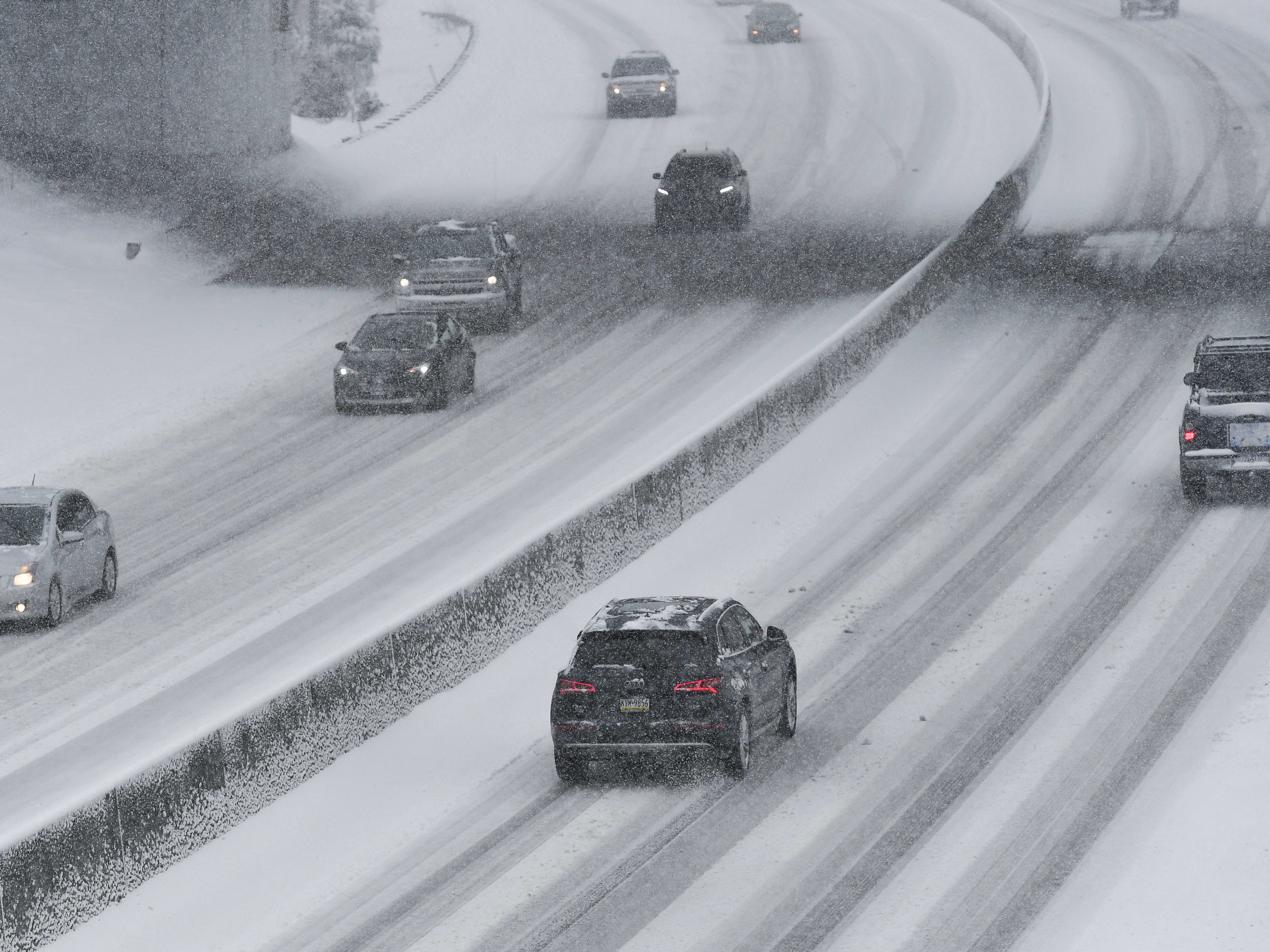
Cars drive on snow covered road Getty Images


Managing Editor, Autoblog

Drivers across several parts of the United States could face dramatically different weather hazards over the weekend and into next week as a powerful weather pattern pushes across the country.

Forecasters say a fast-moving storm system is expected to bring strong winds and heavy snow across the northern tier, while dangerous fire weather conditions develop across the Plains and unusually warm temperatures build across parts of the western U.S.

According to the National Weather Service’s Weather Prediction Center forecast discussion, an intensifying clipper-type system is expected to sweep from the northern Plains into the Upper Midwest and Great Lakes, bringing heavy snow and potentially damaging winds.


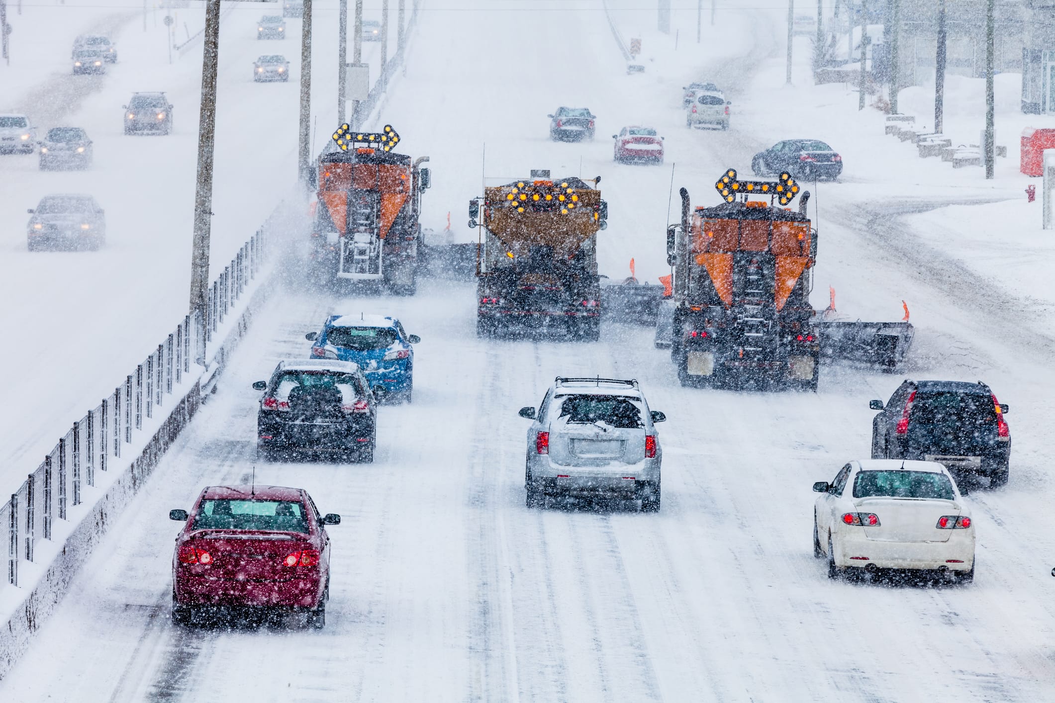
Snowplows removing snow on highway
Getty Images

Saturday, January 23, 2016

Dictatorship By Snow Job: NYC Bans Travel, Threatens Fines Or Arrest For 'Driving'

new york snowfall totals winter storm jonas 2016, new york snowfall totals blizzard 2016, new york snow totals winter storm 2016, nyc snowfall totals winter storm jonas 2016, nyc snowfall totals blizzard 2016, new york city winter storm jonas 2016 snowfall totals, new york city blizzard 2016 snowfall totals

1/23/16

Dictatorship By Snow Job: NYC Bans Travel, Threatens Fines Or Arrest For 'Driving'

Travel ban in New York City

Gov. Cuomo banned all travel in New York City because of a massive snowstorm that could dump 30" of snow on the city.

Cuomo announced a ban on roads in all of lower New York State. Port Authority bridges and tunnels into New York City were also closing. The travel ban was to start at 2:30 p.m.

The governor warned that if you are caught on the road during a ban you could face a large fine. He did not specify what that fine would total.

The ban was to remain in effect "until further notice", according to New York City Mayor Bill de Blasio. "People of New York City have been given warning."

"We will arrest them if needed," De Blasio said about any drivers still on the road during the ban.

----------------------------------------------------

It's January and it's snowing. What? Snowing in January? - it's obviously a dire emergency then. Perfect opportunity to pull some totalitarian authoritarianism out of the old bag of tricks and give it a test run. Only thing needed is to fire up the msm Bureau of Propaganda, turn the hype dial all the way past the full speed mark, and off you go. From there you can script it anyway you want. Travel bans and threats of arrest for driving in the snow? - piece of cake...

'Conditioning' is what this is called. See it once, the next time the people will hardly blink. Dictatorship by snow job it could be said.

Be not snowblinded. Rev. 18:4
***
compare: Paris? 'When Everything...Public Believes Is False'...Disinfo Program Will Be Complete - William Casey CIA/ZWO 1981 1-8-15 "There is only one goal - totalitarian control of the entire planet[see: London 2012]. It will not happen by itself..."
--------------------------------------------------------
Not only snow, but '...truth is fallen in the street' - Isaiah 59:14


by tom m. at 10:29 AM

Thursday, February 13, 2014

Storm Lashes Northeast With Snow After Icing South


Photo (Courtesy) http://www.livescience.com/43378-naming-winter-storms.html

Brian K. Sullivan, ©2014 Bloomberg News
Published 1:37 pm, Thursday, February 13, 2014


(Corrects “above” to “below” in 14th paragraph.)


Feb. 13 (Bloomberg) -- The winter storm that cut electricity to more than half a million customers across the South and grounded 10,000 flights this week turned its power on the U.S. Northeast, bringing heavy snow from Virginia to Maine.

In Washington, 11 inches (28 centimeters) were reported at American International College, said Carl Erickson, a meteorologist at AccuWeather Inc. in State College, Pennsylvania. New York’s Central Park had 9.5 inches by 10:45 a.m. and 12 inches were on the ground in Fort Lee, New Jersey, the National Weather Service said.

At least 14 deaths were blamed on the system as it moved out of the Deep South, the Associated Press reported.

The storm “is going to continue to deepen and strengthen as the day goes on and the snow will expand up through the Boston area up to Maine,” Erickson said. “It looks like there will be a very large swath of 6 to 12 inches from Virginia to Maine.”

The storm contributed to 10,681 flights being canceled across the U.S. in the past three days, said FlightAware, a Houston-based airline tracking service. As of noon New York time, 5,883 flights were scrubbed today.

More than two-thirds of all trips from Washington’s Reagan National Airport were called off, as well as at least half at New York’s LaGuardia, the company said. US Airways, a unit of American Airlines Group Inc., canceled all flights into Charlotte, North Carolina, for the rest of the day.


Power Out


About 610,000 homes and businesses from Arkansas to New Jersey were without power as of 11:30 a.m. New York time, according to utility websites. More than half were in North Carolina and South Carolina. New Jersey and New York utilities reported about 6,000 customers blacked out.

Heavy snow fell in New York, where the weather service increased its forecast to 10 to 16 inches from 8 to 12. The snow was expected to change to sleet and rain later today before beginning again tonight, said Joey Picca, a weather service meteorologist in Upton, New York.

Across western Connecticut, 20 inches may fall and northern New Jersey could get 17, the weather service said.

“We’re looking for more snow to come across the area late this afternoon into the evening and that would give us another few inches,” Picca said.


N.Y. Emergencies


New York Governor Andrew Cuomo declared a state of emergency for New York City, Long Island and the mid-Hudson Valley. He didn’t close roads, as he has done in previous storms, though he urged motorists to stay off them and said there may be shutdowns later.

Cuomo warned residents not to get complacent because of this winter’s frequent snowfalls.

“Don’t get cocky about it, don’t take it casually because any one of them could generate a loss of life,” Cuomo said on a conference call with reporters. “These storms are more frequent and they’re more ferocious.”

New York has had eight days this season with a snowfall of 3 inches or more, the most since 1960-61, according to Weather 2000 Inc. It has also had the most days with maximum temperatures below 32 degrees Fahrenheit (zero Celsius).

The snow even shut down the Heraeus Precious Metals Management gold refinery in Newark, New Jersey.

Baltimore Washington International Thurgood Marshall Airport reported 12.3 inches, Erickson said. More than 8 inches fell in Washington, while Philadelphia reported 8.8.

Government offices in Washington closed, and classes were canceled in Philadelphia and Washington.


Icy South


The South is struggling to recover from snow and ice that has been falling there for the past two days. As of 9 a.m., 19 inches were reported in Cherry Grove, West Virginia, 18 in Winchester, Virginia, and 15 in Saluda, North Carolina, according to the U.S. Weather Prediction Center.

A half-inch or more of ice fell across a wide area of central Georgia, including in Augusta and Marietta, the center said. Three inches coated Forest Acres, South Carolina, where the state asked people not to drive until the storm passes.

A half-inch of ice is all that’s needed to bring down a power line, said Rob Carolan, owner of Hometown Forecast Services Inc. in Nashua, New Hampshire.

The precipitation “is starting to wind down over the Southeast,” Carolan said, and should improve starting tomorrow.

The storm also prompted warnings across eastern Canada from Quebec to Nova Scotia and Newfoundland, according to Environment Canada. Parts of eastern Quebec may get as much as 20 inches of snow, the weather agency said.

After the system pulls away from the Northeast tomorrow, there is a chance a smaller storm could bring an additional 1 to 3 inches from North Carolina to Washington in two days, Erickson said.


--With assistance from Lynn Doan in San Francisco, Jim Polson in New York, Cheyenne Hopkins in Washington, Duane D. Stanford in Atlanta, Mary Schlangenstein in Dallas, Rebecca Penty in Calgary and Freeman Klopott in Albany. Editors: Charlotte Porter, Richard Stubbe


To contact the reporter on this story: Brian K. Sullivan in Boston at bsullivan10@bloomberg.net


To contact the editor responsible for this story: Dan Stets at dstets@bloomberg.net


Source
.
.
.

Wednesday, February 12, 2014

Georgia, an Unlikely Winter Wonderland, Braces for More Snow


By Reuters
Filed: 2/10/14 at 4:30 PM | Updated: 2/11/14 at 2:29 PM


Two weeks ago a 2 inch snowfall brought the Atlanta area to a halt Mark Makela/Reuters


ATLANTA (Reuters) - Officials across the southeastern United States braced on Monday for a blast of freezing rain, snow and ice, with Georgia's governor advising "extreme caution" and declaring a state of emergency across almost one-third of the state.

The storm is expected to bring a wintry mix to a broad swath of the country stretching from Texas to North Carolina, according to the National Weather Service. It comes two weeks after a 2-inch snowfall brought the Atlanta area to a halt, stranding hundreds of thousands of commuters and leading to intense criticism of local and state officials for failing to prepare.

"Ice is the big danger here," Georgia Governor Nathan Deal told reporters. "We are exercising extreme caution."

Widespread power outages are likely from ice forming on power lines, a problem the state did not face during the storm that hit on January 28.

The amount of ice possible could be "catastrophic," a Georgia Power official told reporters, adding the utility was bringing in extra crews from outside the state.

"The next three days are going to be challenging days," Deal said.

Deal, a Republican up for re-election this year, has admitted the state's response to last month's storm fell short and vowed to take steps to be better prepared.

The governor said he had put the state's National Guard on notice on Sunday that they could be called up to help, and he directed transportation officials to have equipment in place in areas where snow and ice are expected.

The state's new system for notifying residents about hazardous weather is ready and may be used over the next few days, Deal said.

Atlanta Mayor Kasim Reed said the city had doubled its ability to salt roads and was coordinating closely with the state and other municipalities after missteps during the previous storm.

"We're going to be in constant contact with the state," Reed said.

Many Atlanta-area school systems announced they would be closed on Tuesday and Wednesday. Some schools in Mississippi also announced cancellations, and the South Carolina General Assembly session was called off again due to the weather.

The weather service said northeast Georgia and the western Carolinas would experience the heaviest precipitation on Wednesday, with snow accumulations of 6 to 8 inches in the mountains.

The largest ice accumulations were expected along the Interstate-20 corridor from Augusta, Georgia, to Columbia and Florence in South Carolina.

Forecasters said widespread travel delays were likely by mid-week across the region.

Arkansas has replenished its stocks of road salt and was pre-treating possible trouble spots ahead of the storm.

"It's been a rough winter for us this year. There are a lot more winter events that we're used to. In a typical year, we spend $6 million a year on weather and I suspect that we've already eclipsed that," said Randy Ort, a spokesman for the Arkansas State Highway and Transportation Department.

Two massive searches in the state were going on ahead of the storm, one for a small plane that disappeared with its pilot on January 31 and the other for a woman who jumped into an icy river over the weekend to avoid a jack-knifed truck skidding her way on a frozen road.


Source
.

Friday, February 08, 2013

Snow hampers manhunt for fugitive ex-cop

Storm batters NY, New England, dumping foot and a half of snow; 500,000 lose power


Blizzard churns toward New York and New England: Storm, poised to dump up to three feet of snow from New York to Boston and beyond beginning Friday afternoon, sends residents scurrying to stock up on food and water and road crews spreading salt and sand.


By Associated Press, Published: February 8 | Updated: Saturday, February 9, 1:00 AM


BOSTON — A storm that forecasters warned could be a blizzard for the history books, with a potential for up to 3 feet of snow, clobbered the New York-to-Boston corridor on Friday, grounding flights, sending office workers home early and knocking out power to half a million customers across the Northeast.

By Friday night, more than 18.5 inches of snow had fallen in parts of central Connecticut, and more than 16 inches covered parts of Mansfield, Mass., a half-hour drive southwest of Boston. Throughout the Northeast, more than 500,000 homes and businesses lost electricity as wet, heavy snow, freezing rain and howling winds caused havoc.


.

P.S. 
The Snow Storm is called Nemo? Is it really OMEN?


.
.

Thursday, February 07, 2013

Flights and Trains Canceled as Storm Heads to Northeast


Richard Perry/The New York Times

In Jersey City, Jose Angelo, left, helped Isauro Palacios, a contractor from Belleville, N.J., as he loaded a new snow blower into the back of his truck Thursday as a snowstorm approached the region.

By MARC SANTORAPublished: February 7, 2013


As a major winter storm made its way up the Atlantic Coast on Thursday, local authorities from New York City to Maine began to make preparations for what forecasters said could be the heaviest snowfall for some cities in the Northeast in a century.


Multimedia
Graphic


Follow us on Twitterand like us on Facebook for news and conversation.

National Weather Service

A satellite image taken at 10:15 p.m. Eastern time Thursday. Areas in blue indicate colder cloud tops or deeper cloud cover. The system over the Midwest and the system spread across the East are expected to merge on Friday.


Airlines began announcing the suspension of flights out of New York and Boston airports starting Friday night, as thousands of workers readied their plows, checked their stocks of salt and braced for what will most likely be a cold, wet weekend. Amtrak announced that it would suspend northbound service out of Penn Station in New York and southbound service out of Boston beginning early Friday afternoon.

Gas stations in parts of New York City and New Jersey had long lines Thursday night, according to local residents, a signal, perhaps, that many were taking storm warnings seriously.

More than 2200 flights for Friday had been cancelled, according to the Web site FlightAware, the majority originiting or departing from the areas affected by the storm.

By late Thursday night, schools across New York and Connecticut had announced they would close, or dismiss students early.

On Long Island, where some forecasts said there could be more than 18 inches of snow, the power company, which has received heavy criticism for its response to Hurricane Sandy, promised customers that they were prepared.

The city of Boston, where forecasts called for more than two feet of snow to fall by Saturday, announced that it would close all schools on Friday, joining other localities in trying to get ahead of the storm and keep people off the roads.

“We are taking this storm very seriously and you should take this storm very seriously,” said Jerome Hauer, the New York State Commissioner of the Division of Homeland Security and Emergency Services, at an afternoon news conference.

“If you don’t have to go to work tomorrow, we suggest that you do not,” he said. “If you do, we suggest that you plan for an early departure.”

The latest forecasts, he said, called for between 12 and 20 inches of snow in the New York City region and wind gusts that could exceed 60 miles per hour.

However, with the storm still some distance away, forecasters warned that predictions could change. The first sign of the storm will be a dusting of light snow that is expected to start falling across the region Friday morning.

At some point Friday night, the arctic jet stream will drop down from Canada and intersect with the polar jet stream, which usually travels through the lower 48 states.

“They will cross somewhere between New Jersey and Nantucket,” said Tim Morrin, a meteorologist at the National Weather Service. “That is where the center of the storm will deepen and explosively develop.”

If the current models hold, the storm could rival the blizzard of 1978 in New England, when more than 27 inches of snow fell in Boston and surrounding cities. That storm, which occurred on a weekday, resulted in dozens of deaths and crippled the region for days.

Peter Judge, a spokesman for the Massachusetts Emergency Management Agency, said more than 20 agencies had gathered at the agency’s operations center in Framingham, Mass., where they were preparing for a historic storm.

“From our perspective, this is a very severe, blizzard-type storm that we haven’t had for quite a long time,” Mr. Judge said. “Worst-case scenario, this will be the worst one that we’ve dealt with in many, many years. I can’t even come up with something comparable.”

Officials prepared for debris management, snow removal and supplies distribution, he said, as well as widespread power failures, which he said were the major concern. “People will lose their heat when they lose their power, and they’re certainly much more in harm’s way than at other times of the year,” he said.

Boston was bracing for the worst of the storm to hit between 2 and 5 p.m. Friday. Gov. Deval Patrick, who called the pending storm “a serious weather event,” has ordered all nonemergency personnel to work from home Friday and encouraged private employers to keep their workers home.

Governor Patrick asked that all vehicles stay off the roads after noon on Friday and said the Massachusetts Bay Transit Authority, including all subway, buses and commuter rail services, would close at 3:30. He said mass transit was being kept open until 3:30 to allow the first shift of emergency and hospital workers to get home and the second shift to get to work.

Boston public schools will be shut, and the governor encouraged all other school districts in the state to cancel classes.

The state is preparing “warming centers” to be open in local communities in case of major power failures and will move people into larger regional centers if they need to stay overnight.

At Logan Airport in Boston, long lines were forming by midafternoon as people tried to flee the storm.

“You don’t know what’s going to happen,” said Martin Stewart, 50, a service technician standing in a lengthy line at the airport. He had moved up his trip to Scotland to make sure he could get out. “Why mess around?” he said.

Two women waiting in line said they were leaving for London as planned but were somewhat wistful about missing a big storm. “We love the snow,” said Lynne Fistori, 36, who is taking a quick trip with her sister-in-law, Laura Fistori, 36. They expect that the men and children whom they are leaving behind will just ration their food and play in the snow.

The eastern-facing coastline — including cities like Scituate, south of Boston, and the Cape Ann area north of Boston — is at risk for major flooding, which could bring “a lot of beach erosion, potential damage of homes along the coast,” Mr. Judge said.

For the past 48 hours, weather predictions for the region have varied wildly, with forecasts calling for something more than a dusting to a car-burying snowfall.

But by Thursday, Mr. Morrin said, there was “enough evidence right now to say the legacy of this storm will be widespread.”

Just what parts of the New York City metropolitan area will be hit hardest will become clearer as the low-pressure system moves north, but Mr. Morrin said that all the forecasting patterns put the storm on “a historically favorable track.”

The morning commute on Friday could be affected by light snowfall. Temperatures are expected to rise during the day, which could mean a snowy, rainy mix — or just rain, Mr. Morrin said.

However, by Friday night, temperatures are expected to drop precipitously as cold air from the north moves down, turning the precipitation into snow.

“When the door opens, it is going to open wide,” Mr. Morrin said.

For New Yorkers, that could mean that the slushy mess from the daytime could freeze, not only creating hazardous conditions on the roads but also weighing down tree branches and power lines.

Michael Clendenin, a spokesman for Consolidated Edison, said the utility was making preparations for the storm and would have extra crews available to deal with any problems.

Mayor Michael R. Bloomberg met Thursday with New York sanitation workers who were preparing for the storm.

“The good news, I guess, if you like snow, is that we’re going to have snow,” Mr. Bloomberg said.

“The better news is that if it’s going to happen, having it happen overnight Friday into Saturday is probably as good timing as we can have,” he added, “because the Sanitation Department then has the advantage of being able to clean the streets when there’s normally less traffic.”

New York State canceled all Civil Service examinations scheduled for Saturday.

Mr. Hauer said that coastal areas of Queens, Brooklyn and Long Island could see flooding and should be prepared to seek alternative shelter. While the storm surge is only expected to be 3 to 5 feet — well below the 14-foot surge that Hurricane Sandy delivered — he said large waves could bring water inland.

“If you see flooding, have plans for somewhere to go,” he said.

As the storm moves north, the heaviest bands of snow and rain would tend to occur northeast of the storm’s center.

“A lot depends on where the heaviest bands of snow develop,” he said. “If a band sits over an area, you can get three inches of snow an hour.”

By Friday morning, he said, it will be clearer where the worst of the storm is likely to hit.


Marc Santora reported from New York. Jess Bidgood and Katharine Q. Seelye contributed reporting from Boston.


This article has been revised to reflect the following correction:

Correction: February 7, 2013

An earlier version of a picture caption with this article misidentified the occupation of Jose Angelo. He is an employee of Isauro Palacios, a contractor. He is not a hardware store employee.


A version of this article appeared in print on February 8, 2013, on page A19 of the National edition.


.

Wednesday, November 07, 2012

Nor'easter Whips Storm-Damaged Tri-State

By Storm Team 4
| Thursday, Nov 8, 2012 | Updated 12:09 AM EST


View more videos at: http://nbcnewyork.com.
Janice Huff's late evening forecast for Wednesday, November 7.

PHOTOS AND VIDEOS


PHOTOS
Your
Nor'easter Snow Photos


PHOTOS
Sandy Hits Tri-State
More Photos and Videos

Another intense storm swirled into the tri-state Wednesday evening, bringing high winds and a wintry mix of rain and snow that caused major commuting problems and further tormented residents who lost power and were flooded out by Sandy.

TRACK THE STORM HERE WITH OUR INTERACTIVE RADAR

The nor'easter brought down tree limbs and electrical wires, and utilities in New York and New Jersey reported that nearly 60,000 customers who lost power because of Sandy lost it all over again as a result of Wednesday's storm.

Icing shut down a part of the Long Island Expressway for several hours. Weather-related problems forced the Long Island Rail Road to temporarily stop trains and close Penn Station to new customers for more than an hour, delivering even more misery to Long Island commuters, who were already dealing with crowding issues after Sandy.

At about 8 p.m., some limited eastbound service resumed from Penn Station and Atlantic Terminal, but hour-long delays persisted. The railroad's Penn Station ticket area, which had been temporarily closed, has reopened.

Here's what you need to know:

NEW YORK CITY AND SUBURBS


Coastal areas of the city will see more rain, while Manhattan and the Bronx will get more of a snowy precipitation.

Through the evening, heavier snow falls from Manhattan to points west, while Queens, Brooklyn and Nassau County will see a mix of snow and rain. A slushy 2 inches of accumulation is possible, especially on grassy surfaces, with sloppy roads and wind gusts of up to 55 mph.

Overnight, the snow diminishes and winds decrease to around 40 mph gusts. Temps will be in the 30s.
New York City schools will be open Thursday for all of the city's 1.1 million students, including students from 43 schools that suffered damage during Sandy and another 13 that still lack electricity. Students from those 56 schools have been relocated to other schools. Most of the new school assignments started Wednesday but some won't start until Thursday.

Long Island Rail Road service was suspended system-wide at about 6:30 p.m. Wednesday because of weather-related signal problems. Limited service has resumed, but hour-long delays persist. The rail service had already been dealing with crowding problems while operating on modified schedules after Sandy.
The Long Island Expressway was temporarily closed in both directions from exits 40E to 41 after 5:30 p.m. because of icing conditions. All lanes are now open.

In New York, Mayor Bloomberg ordered police to use their patrol car loudspeakers to warn residents in vulnerable areas to evacuate. Some 20,000 to 30,000 people live in those areas, he said.

The mayor ordered three nursing homes and an adult care facility evacuated from Queens' vulnerable Rockaway Peninsula because of fears the weather might knock out electricity already being provided by generators. About 620 residents were moved.

The city has closed all parks, playgrounds and beaches, as well as ordering all construction sites to be secured.

Airlines at the area's three major airports had already canceled hundreds of flights in anticipation of the storm and travelers were advised to check with their carriers before heading to the airport.

The Long Island Power Authority was reporting that more than 192,000 customers were without, with nearly 50,000 having lost power in the new storm. More than 79,000 Con Edison customers were without power, 11,000 Con Edison losing power in the new round of bad weather, with the worst damage in Westchester County. Some of those people now in the dark had skated through Sandy unscathed. Others had just gotten their electricity back. Con Ed officials say the bad weather has also slowed restoration efforts.

The New York State Thruway Authority is banning motorcycles and empty trailers from the Tappan Zee Bridge and reducing the speed limit on the bridge to 35 mph.


NEW JERSEY


In coastal New Jersey, heavy bands of rain spiraled onshore and moderate coastal flooding is expected, with a storm surge of 3 to 4 feet. Areas where Sandy washed away sand dunes will see flooding problems, especially during the high tide cycle. Wind gusts of up to 60 mph are expected, with temperatures in the 30s and 40s. The rain tapers off overnight, ending by 8 a.m. as wind gusts decrease to 45 mph.

In interior New Jersey and the lower Hudson Valley in New York, heavy snow falls through the evening, accumulating up to 6 inches, with possibly higher amounts in upper elevations of New Jersey. Expect snow-covered roads, especially near rush hour. Winds of up to 45 mph are expected.

High winds could bring down tree limbs weakened by Sandy, potentially stalling power restoration efforts or causing further outages. A high wind warning is in effect for much of the region through Thursday.

Toms River issued a mandatory evacuation of the Barrier Island for noon Wednesday. There are voluntary evacuations of low-lying areas on the mainland.

Middletown Township in Monmouth County has issued a mandatory 3 p.m. evacuation from Keansburg to Atlantic Highlands from Route 36 to the bay.

Public Service Electric & Gas has roughly 241,000 outages, including 60,000 caused by the nor'easter. Jersey Central Power & Light has 197,560 customers without power, mainly in Monmouth, Morris and Ocean counties, while Orange & Rockland has 8,300 households. Atlantic City Electric is reporting nearly 9,000 customers without power.
aid.

.

Saturday, February 04, 2012

Snow blankets Rome

DAWN.COM
(37 minutes ago) Today

A rare mantle of snow blanketed the historic center of Rome on February 3, forcing the closure of schools and tourist sites such as the Colosseum.

The snow covered palm trees, ancient Roman ruins and Baroque churches across the normally mild-weather Italian capital which has only seen one snowfall in the past 15 years in which the snow stayed on the ground for a whole day. — Photos by AFP

2


Source

.

Monday, October 31, 2011

In Central Park, Snow That Collected on Still-Leafy Branches Fells Even Hardy Trees

By MATT FLEGENHEIMER
Published: October 30, 2011


The storm struck trees of all ages and sizes in Central Park: oaks and elms outside the boathouse, birches and dogwoods near Belvedere Castle, magnolias and mulberries beside the obelisk.


The damage was spread across about half of Central Park’s 840 acres, making it the worst devastation that Douglas Blonsky, president of the Central Park Conservancy, had seen in his 27 years there.

In all, as many as 1,000 of the park’s trees may be lost to the freak October snowstorm; in contrast, Tropical Storm Irene — which work crews only recently finished cleaning up after — cost the park 125 trees.

“It’s like a bomb blew off,” Mr. Blonsky said, as he conducted a site survey of the park on Sunday. He looked out his car window at a 70-foot oak tree, near the park’s southeast entrance. Only a jagged stump remained.

“Boom,” Mr. Blonsky said softly.

Though the snowfall in the city might have been considered mild by winter standards, a confluence of factors contributed to what Mr. Blonsky called unprecedented damage. Snow became suspended on leaves that had not yet fallen for winter, tugging at limbs and, in some cases, felling entire trees. And because temperatures hovered near freezing, and not well below, the snow was often damp and heavy, creating additional pressure on fragile branches.

A new round of restorations could take months, though workers are already scrambling to ensure that the New York City Marathon can proceed as planned on Sunday.

“Couldn’t have been rain, huh?” Neil Calvanese, vice president for operations of the conservancy, said from the back seat of Mr. Blonsky’s car.

“Couple degrees,” Mr. Blonsky said.

Mr. Calvanese sighed. “Fall colors were just starting to kick in,” he said.

Even the most durable trees struggled to cope. The broad, rough leaves of a London plane tree, Mr. Calvanese said, made it particularly vulnerable to snow accumulation and, consequently, branch fractures.

“It’s a resilient tree,” Mr. Calvanese said, sounding like a coach defending his players after a difficult loss. “They really do hold up well.”

Most of the damage occurred in the area south of 86th Street, where the park receives its highest concentration of visitors. Though the park was open on Sunday — and quite busy, given the improved weather and curiosity about the damage — Mr. Blonsky expressed concern that “hangers,” limbs detached from their trees but still suspended overhead, could prove dangerous if visitors ignored the conservancy’s caution tape. “You’ve got people pushing strollers underneath trees,” he said.

The city’s storm damage was not confined to the park. By 4 p.m. on Sunday, the city had received more than 2,000 calls reporting tree damage. About half had come from Staten Island, and a quarter from the Bronx, said Adrian Benepe, commissioner of the city’s parks department. “We’ve never seen a storm like this in October, when the trees are still mostly in full leaf,” Mr. Benepe said. “I’ve never seen such widespread damage.”

Christine Cea, from Emerson Hill, Staten Island, said a quick drive through surrounding neighborhoods revealed the storm’s leafy detritus, strewn along the roadways. “It was disappointing for a green borough,” she said.

For Central Park, the only comparable episode in recent years was a brief but powerful thunderstorm in August 2009, which resulted in the loss of 500 trees. In that case, as in this one, the damage did present a silver lining: the opportunity to improve park aesthetics by examining whether affected areas look better without so many trees. On Sunday, Mr. Blonsky noted that a reduction in trees in the southwest corner of the park, near Columbus Circle, was allowing more sunlight to the area.

But optimism dissipated quickly as Mr. Blonsky approached a contracting crew near Fifth Avenue, where fallen limbs were being loaded into a wood chipper. “You’re going right to the core of what Central Park is about,” he said of the park’s more than 23,000 trees.

Mr. Calvanese dropped his head, as the crew hauled another branch toward the machine.

“I’m not ready for this,” he said

.


Sunday, October 30, 2011

3M powerless as October snow surprises Northeast

October 30, 2011 4:21 PM


(AP) SOUTH WINDSOR, Conn. — When winter's white mixes with autumn's orange and gold, nature gets ugly.

A freak October nor'easter knocked out power to more than 3 million homes and businesses across the Northeast on Sunday in large part because leaves still on the trees caught more snow, overloading branches that snapped and wreaked havoc. Close to 2 feet of snow fell in some areas over the weekend, and it was particularly wet and heavy, making the storm even more damaging.

"You just have absolute tree carnage with this heavy snow just straining the branches," said National Weather Service spokesman Chris Vaccaro.

From Maryland to Maine, officials said it would take days to restore electricity, even though the snow ended Sunday.

The storm smashed record snowfall totals for October and worsened as it moved north. Communities in western Massachusetts were among the hardest hit. Snowfall totals topped 27 inches in Plainfield, and nearby Windsor had gotten 26 inches by early Sunday. It was blamed for at least three deaths, and states of emergency were declared in New Jersey, Connecticut, Massachusetts and parts of New York.

Roads, rails and airline flights were knocked out, and passengers on a JetBlue flight were stuck on a plane in Hartford, Conn., for more than seven hours. And while children across the region were thrilled to see snow so early, it also complicated many of their Halloween plans.

Sharon Martovich of Southbury, Conn., said she hoped the power will come back on in time for her husband's Halloween tradition of playing "Young Frankenstein" on a giant screen in front of their house. But no matter what, she said, they will make sure the eight or so children who live in the neighborhood don't miss out on trick-or-treating.

"Either way we will get the giant flashlights and we will go," she said.

More than 800,000 power customers were without electricity in Connecticut alone — shattering the record set just two months ago by Hurricane Irene. Massachusetts and New Jersey had more than 600,000 outages each, and parts of Pennsylvania, New Hampshire, New York, Maine, Maryland and Vermont also were without power.

"It's going to be a more difficult situation than we experienced in Irene," Connecticut Gov. Dannel P. Malloy said. "We are expecting extensive and long-term power outages."

Thirty-two shelters were open around the state, and Malloy asked volunteer fire departments to allow people in for warmth and showers. At least four hospitals were relying on generators for power.

Around Newtown in western Connecticut, trees were so laden with snow on some back roads that the branches touched the street. Every few minutes, a snap filled the air as one broke and tumbled down. Roads that were plowed became impassible because the trees were falling so fast.

One of the few businesses open in the area was a Big Y grocery store that had a generator. Customers loaded up on supplies, heard news updates over the intercom, charged up their cell phones, and waited for a suddenly hard-to-get cup of coffee — in a line that was 30 people deep and growing.

Many of the areas hit by the storm had also been hit by Irene. In New Jersey's Hamilton Township, Tom Jacobsen also recalled heavy spring flooding and a particularly heavy winter before that.

"I'm starting to think we really ticked off Mother Nature somehow, because we've been getting spanked by her for about a year now," he said while grabbing some coffee at a convenience store.

It wasn't just the trees that weren't fully ready for a wintry wallop.

Kerry McNiven said she was "totally unprepared" for the storm that knocked out her water and power and sent tree limbs crashing into her Simsbury, Conn., home. She was buying disposable plates and cups in a darkened supermarket, a setting that she said resembled "one of those post-apocalyptic TV shows."

"They didn't hype this one as much" and Irene, she said. "I didn't think it was going to be as bad."

In Concord, N.H., Dave Whitcher's company had yet to prep its sanding equipment before the storm dropped nearly 2 feet of snow. His crews were plowing and shoveling parking lots Sunday, and would be back Monday to salt sidewalks and walkways.

"It was a bit of a surprise, the amount and how heavy it was. We should've probably come out and got a little earlier start, but we did all right," Whitcher said. He held up his shovel and added, "Me and this guy are going to get to know each other real well today."

Vaccaro, the weather service spokesman, said the snowstorm "absolutely crushed previous records that in some cases dated back more than 100 years." Saturday was only the fourth snowy October day in New York's Central Park since record-keeping began 135 years ago.

There usually isn't enough cold air in the region to support a nor'easter this time of year, but an area of high pressure over southeastern Canada funneled cold air south into the U.S., Vaccaro said. That cold air combined with moisture coming from the North Carolina coast to produce the unseasonable weather.

Though the fact that leaves were still on the trees worsened storm damage inland, the nor'easter did less damage in coastal areas than it would have in winter because warm ocean temperatures limited snowfall, Vaccaro said.

A few businesses enjoyed the early snow: Ski resorts in Vermont and Maine opened early. But it was more commonly an aggravation.

Many residents were urged to avoid travel altogether. Speed limits were reduced on bridges between New Jersey and Pennsylvania. A few roads closed because of accidents and downed trees and power lines, said Sean Brown, a spokesman for the Pennsylvania Department of Transportation.

The JetBlue passengers stranded at Hartford's Bradley International Airport were on a flight from Fort Lauderdale, Fla., to Newark, N.J., that had been diverted. Passenger Andrew Carter, a football reporter for the Sun Sentinel in Fort Lauderdale, said the plane ran out of snacks and bottled water, and the toilets backed up.

JetBlue spokeswoman Victoria Lucia said power outages at the airport has made it difficult to get passengers off the plane, and added that the passengers would be reimbursed.

In 2007, passengers in JetBlue planes were stranded for nearly 11 hours at New York's Kennedy Airport following snow and ice storms.

There were other flight delays in the region over the weekend, and commuter trains in Connecticut and New York were delayed or suspended because of downed trees and signal problems. Amtrak suspended service on several Northeast routes, and one train from Chicago to Boston got stuck overnight in Palmer, Mass. The 48 passengers had food and heat, a spokeswoman said, and they were taken by bus Sunday to their destinations.

In southeastern Pennsylvania, an 84-year-old man was killed when a snow-laden tree fell on his home while he was napping in his recliner. In Connecticut, the governor said one person died in a Colchester traffic accident that he blamed on slippery conditions.

And a 20-year-old man in Springfield, Mass., stopped when he saw police and firefighters examining downed wires and stepped in the wrong place and was electrocuted, Capt. William Collins said.

The snow was a bone-chilling slush in New York City, and was a taste of what's to come for demonstrators camping out at Zuccotti Park in lower Manhattan for the Occupy Wall Street protest.

Nick Lemmin, of Brooklyn, spent his first night at Zuccotti in a sleeping bag in a tent, wearing thermals, a sweatshirt and a scarf.

"I slept actually pretty well," he said. "It was pretty quiet."

Lemmin said he thought the early snow was actually "a good test," giving protesters a chance to deal with such weather before it sets in more permanently.

The weather was too much for protester Adash Daniel, who had already been in the park for three weeks. "I'm not much good to this movement if I'm shivering," he said as he left.

The snow was relatively light in Manhattan, as it was farther north in Albany, where a couple of dirt- and leaf-caked snowmen stood about the protesters waving "We are the 99 percent" signs for passing cars.

In Concord, 9-year-old Nate Smith had more than enough snow to make a proper snowman with his brother, but he was worried about Halloween. He wasn't sure he'd be able to go trick-or-treating, and even if he did, his werewolf costume could end up looking a little different than he had imagined.

"I might have to put on snow pants," he said.

___

Associated Press writers Noreen Gillespie-Connolly in Newtown, Conn.; Ron Todt in Philadelphia; Verena Dobnik, Deepti Hajela and Candice Choi in New York; Mary Esch in Albany, N.Y.; Holly Ramer in Concord, N.H.; and Bruce Shipkowski in Trenton, N.J., contributed to this report.



Saturday, October 29, 2011

Nearly 1.5M lose power in Oct. snow storm

October 29, 2011 7:17 AM


http://www.cbsnews.com/8301-201_162-20127407/nearly-1.5m-lose-power-in-oct-snow-storm/

CBS/AP) Last Updated 6:26 p.m. ET


A powerful storm system bringing a mix of rain and snow chugged up the East Coast, knocking out power to nearly a half-million customers Saturday. The nor'easter is expected to dump up to 10 inches or more throughout the region, and the unseasonably early snow has already broken records in New York City.Most of those without power are in Pennsylvania. Utilities there say 428,000 customers have lost power - more than 160,000 are in Philadelphia and its suburbs.

In Connecticut, utilities reported more than 125,000 without service.

In New York, sporadic power outages are centered near Poughkeepsie and Newburgh.

Half a million are without power in New Jersey, including Gov. Chris Christie, who declared a state of emergency.

Spokesman Todd Meyers says Potomac Edison, the dominant utility in western Maryland, had more than 26,000 outages.

Flight delays are reported of three hours at Philadelphia International Airport; five hours at John F. Kennedy and LaGuardia in New York City; and six hours at Newark Liberty. Teterboro Airport in New Jersey is closed.

The National Weather Service said that as of 2 p.m. today Central Park recorded 1.3 inches of snowfall - the most to fall there in October since snowfall records were kept beginning in 1869.

Forecasters say New York could see up to four inches.

18 Photos
Rare Oct. snowstorm hits Northeast
View the Full Gallery »

The heavy, wet snow combined with fully leafed trees could lead to downed tree branches and power lines, resulting in numerous power outages, officials said.

West Penn Power reports Saturday afternoon about 16,000 customers are without power in Pennsylvania. In Maryland 27,000 Potomac Edison customers are without power. In West Virginia, outages are affecting nearly 26,000 Mon Power customers.

CBS "Early Show" meteorologist Addison Green reports that 12 states are currently under a Winter Storm Warning, spanning from Virginia and West Virginia up to Maine.

Almost a foot of snow was reported in Snowshoe Mountain, W.Va., with 11" as of 2 p.m. Central Pennsylvania has seen half a foot around State College and about 2-4" near Harrisburg.

Snow is continuing to melt as it comes down and hit the ground but as it does so, it is also cooling the ground, so snow will start sticking and piling up as the storm system tracks to the northeast along the coast.

For instance, Hartford, CT could see around 8" fall from the sky, but only about half of that will stick and pile up on the ground.

The rain just started to come down in Boston and they could see an inch or so of snow once the precipitation changes over later in the overnight hours.

Further up in New Hampshire, it is just cloudy, but rain will quickly move in for places like Concord and Portsmouth and then change over to snow by 9 tonight.

Records for snow could be broken up and down the I-95 corridor.

For the month of October, Philadelphia saw a record breaking 2.1" back in 1979 and Boston just over an inch (1.1") in 2005.


Here are some forecast snowfalls in the East:

Philadelphia - 1-3"
New York City - 4-6"
Albany - 2-4"
Pittsfield, Mass. - 5-7"
Scranton, Pa. - 3-5"
Worcester, Mass. - 6-8"

The other problem with this storm is the wind. A 30 mph wind gust was reported in LaGuardia Airport earlier in the day, 33 mph in Atlantic City, N.J, 31 mph at Logan International in Boston, and 24 mph in New York City.

A High Wind Warning with wind gusts of 40-60 mph is reported for Cape Cod, eastern Mass., most of Rhode Island and the eastern half of Long Island later this evening and in the overnight hours.

By tomorrow morning, the storm system will be east of Maine where Portland and Bar Harbor will be dealing with wet, heavy snow and wind gusts over 40 mph.

Relatively warm water temperatures along the Atlantic seaboard could keep the snowfall totals much lower along the coast and in cities such as Boston, National Weather Service meteorologist Bill Simpson said, with 1 to 3 inches of snowfall forecast along the I-95 corridor.

October snowfall records could be broken in parts of southern New England, especially at higher elevations, National Weather Service meteorologist Bill Simpson said. The October record for southern New England is 7.5 inches in Worcester in 1979.

More than 6 inches of snow could accumulate in parts of Maine on Saturday. Parts of southern Vermont could receive more than a foot of wet snow Saturday into Sunday.

In Connecticut, Gov. Dannel P. Malloy warned residents that they could lose power due to the anticipated wet, heavy snow.

In Pennsylvania, snow was falling in Allentown and Reading in the eastern part of the state. Philadelphia has seen mostly rain with a few drifting flakes, but that is expected to turn to snow as temperatures fall, the weather service said.

Philadelphia was expected to get 1 to 3 inches, its first measurable October snow since 1979 -- with 2 to 4 inches in some suburbs, meteorologist Mitchell Gaines said.

Allentown is expected to see 4 to 8 inches, likely to break the city's October record of 2.2 inches on Halloween in 1925.

"This is very, very unusual," said John LaCorte, a National Weather Service meteorologist in State College, Pa., where heavy snow was falling Saturday morning.

LaCorte said the last major widespread snowstorm to hit Pennsylvania this early was in 1972.

"It's going to be very dangerous," he added.

Rain and snow are expected to fall most of the day Saturday in New York City, with just snow falling overnight. Forecasters predict 2 to 4 inches will accumulate.

October snowfall is rare in New York; there have been just three October days with measurable snowfall in Central Park in the last 135 years when record-keeping began, according to the National Weather Service. The largest on record was in 1925 when eight-tenths of an inch fell in Central Park.

In New England, the first measurable snow usually falls in early December, and normal highs for late October are in the mid-50s.

"This is just wrong," said Dee Lund of East Hampton, who was at a Glastonbury garage Friday getting four new tires for her car before a weekend road trip to New Hampshire.

Lund said that after last winter's record snowfall, which left a 12-foot snow bank outside her house, she'd been hoping for a reprieve.

But not everyone was lamenting the unofficial arrival of winter.

Two Vermont ski resorts, Killington and Mount Snow, planned to start the ski season early by opening one trail each over the weekend, thanks to the recent snow and cold.


Source

Friday, October 28, 2011

Heavy snow to hit northeast US

Page last updated at 18:13 GMT, Friday, 28 October 2011 19:13 UK


Heavy snow to hit northeast US

Heavy snow and rain are forecast to affect the northeastern states of the US
over the next couple of days.

An area of low pressure tracking across the eastern seaboard will bring
significant snowfall, which could cause severe disruption across Virginia,
Pennsylvania, New Jersey, New York State and parts of New England.
John Hammond has the latest forecast for the areas likely to be hit by the
snow.
.
.

Wednesday, January 12, 2011

T is open, but thousands without power due to morning blizzard

January 12, 2011 07:51 AM


By John R. Ellement, Globe Staff

The number of homes and businesses without power is steadily escalating in Massachusetts this morning as heavy, wet snow and powerful gusting winds are downing power lines and causing whiteout conditions on the highways where dozens of crashes have already been reported.

Public officials are urging the public to stay home or use public transportation if necessary.

MBTA General Manager Richard Davey said the sprawling transit system is experiencing some delays, and has had to start shuttle bus service when a tree took down the power supply near the Green Line’s Riverside station.

“Ridership is light, but we are open for business to the extent that folks cannot stay at home today,'' he said.

Davey said mbta.com is experiencing heavy usage. Riders can also call 617-222-3200 where operators can provide the same information usually available on-line.

As of 7:30 a.m., buses are in use between Riverside and Newton Highlands stations because of a downed power line. Buses are also being used to replace the Red Line’s Mattapan high speed line. Commuter boat service from Hingham has been canceled, Davey said.

Logan Airport is open, but Massport spokesman Phil Orlandella said today that airlines have already canceled some 350 flights and the prospects for anyone flying out of East Boston today are not good.

“It looks like gloom and doom today,’’ he said. Orlandella said Massport will get an update from airlines later today on when flights will resume. The storm system is impacting air travel in other parts of the country.

Orlandella urged travelers to check with their airlines before coming to the airport. He noted many airlines are waiving fees for rebooked flights.

At 7:45 a.m. today, National Grid reported that 58,000 customers are now without power in a band that stretched from the Rhode Island border to the North Shore. Heaviest hit, however, are Plymouth County where 25,000 customers have lost power and Essex County where 11,000 are in the dark.

NSTAR reported 5,000 customers without power mostly on Cape Cod.

The National Weather Service said this morning that the worst of the blizzard will hit Massachusetts by 8 a.m., before ending this afternoon. Snow will fall 2 to 3 inches an hour at the height of the blizzard and could total 16 inches or more in parts of the region, the weather service said.

Peter Judge, spokesman for the Massachusetts Emergency Management Agency, said the main concern for today will be damage to energy supplies from the heavy, wet snow. He said the coastal regions, which saw damaging flooding in last month's nor'easter, are likely to be spared this time because of astronomically low tides and the path the storm is taking.

All state offices and courthouses are closed and dozens of school systems, colleges, and religious institutions are also closed today.

Nearly 4,000 pieces of plows and snow moving equipment have been at work on the state highways since 4 a.m., according to the Massachusetts Department of Transportation. State Police has lowered the speed on the Massachusetts Turnpike to 40 miles per hour.

State Police spokesman David Procopio said this morning that dozens of crashes have been reported on state roads. None, however, resulted in serious injuries or fatalities. Roads are icy and whiteouts have led numerous drivers to head the wrong way on highway ramps.

Boston.com’s traffic partner, sigalert.com, is indicating speeds major roads in greater Boston are generally well below normal.
.
Source
.

Friday, December 31, 2010

John Lindsay and New York snowstorm: A chilling lesson for Michael Bloomberg


Jon Swaine


Jon Swaine is the Daily Telegraph's New York correspondent. He was a member of the MPs' expenses reporting team.


John Lindsay and New York snowstorm: A chilling lesson for Michael Bloomberg


By Jon Swaine World Last updated: December 30th, 2010


Can the Mayor of New York recover from Bloomberg's Snowstorm? (Photo: Getty)
A blizzard dumps tonnes of snow on New York, crippling large sections of the city. Outer borough residents go for days without seeing a snow plough, and complain furiously as people begin to die. The mayor, a popular, party-switching chap tipped as a future US presidential candidate, suddenly finds his administration – which was slow to react – is in crisis. The year? 1969.

Forty-one winters later and, to use Mark Twain’s expression, history is rhyming. As he attempts to finally get a grip on the “snowpocalypse” continuing to blight the city, Michael Bloomberg, the Mayor of New York, may have one name running through his mind: John Lindsay.

Mr Lindsay was in charge when, on a Sunday in February, 15 inches of snow fell on the city, exceeding the expectations of the national weather forecasting agency (unlike this week, when they were spot-on). To make matters worse his environmental protection chief was stuck upstate and much of the city’s snow-clearing equipment was in disrepair.

The results were catastrophic. In all, 42 people died and 288 were injured. Schools were closed, everything was cancelled. The city’s transport system ground to a halt and (like this week) emergency services could not reach stricken people stuck in their homes. Mr Lindsay soon came under fire for his underwhelming response. The blizzard became known as Lindsay’s Snowstorm.

While plenty of residents have vented their anger at the mayor on local media this week, Mr Bloomberg has so far avoided a single blow as devastating as the one delivered to Mr Lindsay by Ralph Bunche, a senior US diplomat at the United Nations.

Dr Bunche happened to live in Kew Gardens, Queens, and wrote to Mr Lindsay to tell him what he could see. “We have never experienced such neglect in snow removal as now,” he said. “The snowstorm came on Sunday. This message is sent Wednesday morning. In all that period no snowplow has appeared on our street or in our vicinity.

“There are no buses, no taxis, no mail, newspaper or other deliveries, and there have been no trash or garbage collection since last Friday. The shelves of our neighborhood grocer are empty. As far as getting to the United Nations is concerned, I may as well be in the Alps.”

The mayor was suddenly minded to visit Queens, where he was roundly abused by people attempting to dig themselves out of the snow. A woman told him he should be ashamed of himself. Later that year, he lost the Republican primary for the mayoral election.

Mr Lindsay’s career was not immediately destroyed by his eponymous blizzard. He was re-elected as an independent mayor (Mr Bloomberg has already done that) and served a full second term. But it never quite recovered. After becoming a Democrat, he failed to win his new party’s nomination for the 1972 presidential election, earning a miserable 1.23 per cent of primary votes in the contest eventually won by George McGovern. At just 52, he retreated from public office and took up acting, novel-writing and media punditry. At least one historian ranks him New York’s worst mayor of the 20th century.

Mr Bloomberg has repeatedly stressed he is not interested in running for president. But rumours persist that he would launch a bid as an independent if or when the political conditions indicate that he could win. If the chaotic aftermath of the Blizzard of 2010 – or should that be Bloomberg’s Snowstorm? – lasts much longer, he may be waiting a long time.

Source

,

Saturday, February 27, 2010

Crews scramble to restore power in Northeast

3rd blizzard in a month pummels region, causing travel and electricity chaos


A driver stops as a tree hangs over a power line over a road in Farmington, N.H., on Friday. More than a million homes and businesses in the Northeast were left without power after an overnight storm with high winds knocked down trees.


View images from the two snowstorms that blanketed the Northeast in two days.


NBC News and news services
updated 8:57 a.m. ET, Sat., Feb. 27, 2010


ALBANY, N.Y. - Utility crews pushed through deep drifting snow, fallen trees and downed power lines Saturday to restore electricity to more than a million homes and businesses that lost power a day earlier as a slow-moving winter storm pounded the Northeast with heavy snow, rain and hurricane-force winds.

Snowfall amounts varied throughout the Northeast, but nearly every state was left to deal with the fallout of powerful, gusting winds that created near-blizzard conditions in some areas that have faced three strong storms this month.

Power failures were severe and widespread, ranging from more than 330,000 in New Hampshire, to over 200,000 in Connecticut and New York and more than 100,000 in Maine and Massachusetts at the storm's peak.


Thursday, January 28, 2010

Ice, snow chill southern Plains amid power outages

By TIM TALLEY Associated Press Writer © 2010 The Associated Press
Jan. 28, 2010, 9:22PM

Ben Woloszyn AP
A Stillwater, Okla. Firefighter walks around a rolled over Chevy pickup truck on the southbound side of Interstate 35 at the Oklahoma Highway 51 interchange on Thursday, Jan. 28, 2010. No injuries were reported in the accident. (AP Photo/Stillwater NewsPress, Ben Woloszyn)


OKLAHOMA CITY — A powerful storm dumped snow, sleet and freezing rain on the southern Plains Thursday, disrupting power to thousands of homes and businesses, canceling flights and shutting down major highways across three states.

The National Weather Service issued winter storm warnings through Friday for much of Oklahoma and the Texas Panhandle.

Ice accumulations of more than one-half inch and high winds snapped electrical lines across Oklahoma, knocking out electrical power to tens of thousands of customers.

"In some places, as far you can see there are hundreds of utility poles on the ground," said Andrea Chancellor, spokeswoman for Public Service Company of Oklahoma.

"It could be five days for all customers who can take power to get power restored," she said.

Airlines canceled more than 100 flights at Will Rogers World Airport in Oklahoma City over concerns about icing on aircraft, spokeswoman Karen Carney said. She said additional flights will likely be canceled Friday morning.

Another 35 flights were canceled at Tulsa International Airport, said Alexis Higgins of the Tulsa Airport Authority.

Many flights in and out of Lubbock, Amarillo and Wichita Falls airports in Texas were canceled.

The Oklahoma Highway Patrol said a 50-mile stretch of Interstate 44 southwest of Oklahoma City was closed due to downed power lines in the roadway. Toppled power lines also forced the closure of a portion of Interstate 40 in far western Oklahoma.

In New Mexico, eastbound I-40 was closed from Tucumcari 40 miles east to the Texas state line because of snowpacked, icy conditions. Difficult driving conditions also were reported in the Santa Rosa area 60 miles west of Tucumcari, and snow was accumulating on I-40 east of Albuquerque.

The Texas Department of Transportation closed I-40 Thursday night from the New Mexico state line to the Texas-Oklahoma border. It also closed U.S. 87 and U.S. 287 from Amarillo north and U.S. 54 from the Texas-Oklahoma border to the New Mexico line after about 13 inches of snow accumulated in the northern Panhandle by nightfall.

In parts of West Texas, heavy snow and freezing precipitation downed tree limbs and power lines.

National Weather Service meteorologist Justin Weaver said the storm could generate up to 8 inches of snow in counties northwest of Lubbock.

The Oklahoma Department of Emergency Management said up to 12 inches of snow is likely in northwestern Oklahoma and the Oklahoma Panhandle. Freezing rain and sleet was forecast to turn to snow in central Oklahoma.

_____

Associated Press reporters Betsy Blaney in Lubbock, Texas, and Heather Clark in Albuquerque, N.M., contributed to this report.
.
.
.